Windy kitesurfing forecast: reading Windy, Windguru and ALADIN
I read a forecast in 4 steps: average wind, gusts, wind direction relative to the shore and how it changes through the day. Then I compare a few models and check available local readings and the water at the spot.
For a Windy kitesurfing forecast, start with your spot and the hours you plan to ride. Check the wind strength, gusts and direction, then compare the models available there. Windguru and national models such as ALADIN help you check the same things; the way they present the forecast differs.
No app will tell you to the minute what your beach will look like. A forecast helps you rule out unsuitable days, but you still need to assess conditions at the spot. When you start riding without an instructor, arrange help with launching and landing.
4 things to check in any forecast
Average wind. Kiters think in knots. 1 knot is 1 nautical mile per hour, which is 1.852 km/h or about 0.5 m/s. If your Windguru shows m/s or km/h, switch wind speed to knots in the Options menu. Windguru gives the wind at 10 m above the ground. How many knots you need for your kite is covered in how much wind you need to kitesurf.
Gusts. The gust figure is a model estimate of short bursts of stronger wind. The time interval depends on the model and its output; the number does not guarantee that a stronger gust won't arrive. Watch the gap above the average wind speed. A large gap means the model expects gusty wind: the kite can pull hard, then go soft, which is difficult for beginners. I cover when gusts mean staying on the beach in gusty wind and turbulence.
Wind direction relative to the shore. On Windguru the arrow points where the wind is blowing to, so downwind. Wind is still named after where it comes from: hover over the arrow and you will see something like "NW (320°)", a north-westerly. Always lay that direction over the map of your spot. Offshore means the wind blows from the beach out to the water and carries you away from land. Without a rescue boat, that is a no-go day for a beginner. More in onshore, offshore and sideshore wind explained.
How it changes through the day. Look at the whole window you want to ride, including the hours after you arrive. Watch for a sharp rise or drop in strength, a change in direction and rain. These can warn of a front or storm; I wouldn't decide a day is safe just because the table shows no rain.
| What you see in the forecast | How to read it |
|---|---|
| Average and gusts close together, arrows steady all afternoon | The model expects steady wind; suitability also depends on strength, direction relative to shore, the spot and your ability |
| Gusts far above the average | Patchy wind, the kite pulls and then goes soft |
| Arrow pointing from the beach out to the water | Offshore, the wind carries you away from land |
| Wind climbs or drops fast within a few hours, with rain | Possible front or storm; finish riding, land and secure the kite well ahead of it, as gusts can arrive before the cloud |
Windguru: a table for each model
Windguru was built for windsurfers and kitesurfers, and its core is the colour-coded table. Each spot gets a separate table for each model. The number after the model name is its resolution in kilometres. GFS 13 km is a coarse global model, while something like UKV 2 km in the UK or HRRR 3 km in the US sees the terrain in far more detail. The "init" time tells you how fresh the data behind the run is, and it is shown in UTC. The hours in the table are local.
The table marked WG is a weighted mix of the available models, taking resolution and data age into account. If you don't want to go through every table straight away, start there. The individual models below it show where the forecasts differ.
2 things that catch people out:
- The stars (Windguru rating) are, in Windguru's own words, a somewhat historic guide for windsurfing, based mainly on wind speed. They say nothing about direction or gusts.
- On the free version, the high-resolution models are fully available only at spots Windguru set up itself. For your own custom spots and any point on the map you need PRO, currently 25.90 EUR a year.
How far ahead to trust it: Windguru itself says forecasts up to 3 days are generally reliable, 5 to 7 days can still be of some value and anything beyond that is largely speculative.
Why the sea can be windier than the table says
A forecast for a coastal point can underestimate the wind on the water. Windguru's CS+ switch takes wind from a point further offshore, but it is experimental and does not guarantee a better result. If the water is windier than the table suggests, don't automatically add a few knots. Compare the forecast with suitable local readings and conditions where you will actually ride.
Windy: the map that shows what is coming
Windy is at its best as a map. The animation shows where the wind comes from, how it bends around the coast and where a front is heading. For a single point it gives you a detailed forecast and a Compare view with all the models available there side by side. The global ones include ECMWF at about 9 km, ICON at about 13 km and GFS at about 22 km, and in Europe you also get ICON-EU at about 7 km.
I'd use Windy for the big picture and Windguru for the table of a specific spot. Windy can also compare what a weather station measured with what the models predicted over the last few days. At a spot you ride often, that helps you see which model tends to match local readings.
National models: ALADIN and friends
Many countries have a fine-grid model of their own. In the Czech Republic a lot of people check ALADIN, the model of the Czech Hydrometeorological Institute, which uses a grid of about 2.3 km and forecasts up to 72 hours ahead. The official Počasí ČHMÚ app shows it as a meteogram with average wind and gusts. Windguru carries ALADIN 2.3 km for Central Europe and ALADIN 1 km for the Czech Republic, alongside UKV 2 km for the UK, HRRR 3 km for the US and many others.
A fine grid represents hills and valleys in more detail, so these models are useful for tomorrow and the day after. Their forecast lengths differ: ALADIN won't cover a weekend 5 days away, while some UKV runs reach 120 hours, or 5 days. Check where the forecast ends in the table you are using. For longer-range planning, compare ECMWF, ICON and GFS too, and expect the picture to shift.
When the models disagree
- Treat agreement as a useful sign. I wouldn't automatically dismiss the model that differs. It may capture local conditions better, and regional forecasts can depend on the same global model. Look back at which models usually match your spot.
- Compare the same place and time. Check the init time and the hours the forecast covers. Compare an older run with a fresh one to see whether the outlook is changing.
- Check the station itself. The nearest station is not necessarily suitable. Check its location, how recent its readings are and whether trees or buildings shelter it in today's wind direction. Compare readings with the forecast for the same hour; a quiet morning alone doesn't disprove a windier afternoon.
- Wait if you can't confirm conditions. Without a suitable station, you are missing a local check. If models disagreed sharply or I couldn't assess the conditions at the spot, I'd stay off the water.
What a forecast can't see
A model with a 1 to 13 km grid doesn't see the edge of the forest next to your spot, the buildings or the shape of the beach. At Moldava in the Ore Mountains, when the wind comes off the forest and you ride close to it, the kite gets jumpy and unpleasant to fly, and you need to move further away. You only learn details like that on the spot.

Then there is thermal wind. A sea breeze forms when the land heats up more than the water. Regional models can capture it, but its strength and arrival time at your spot may differ from the forecast.
Watch the clouds too. A rapidly growing cumulus cloud or an approaching line of cloud can warn of a sudden wind change. A gust front can arrive far ahead of the cloud and rain. Finish your session, land and secure the kite well in advance; don't wait for the visible front or the first increase in wind.
The final word goes to what you see at the spot: flags, the water surface, other kites in the air. The rest of what you need to learn before riding without an instructor is in kitesurfing safety: what every rider must know.
A forecast worth a long drive
In June 2025 a forecast got me in the car to Rügen. It looked good enough that I didn't mind a 9-hour round trip, which is what I wrote on Instagram at the time.
Before a drive like that, I'd check the forecast again the evening before leaving and compare it with any suitable local readings in the morning. The station needs to represent the spot in that wind direction. Where the wind comes from at a given spot and where to launch is on the kite spots map.
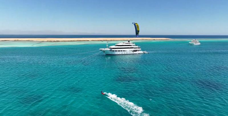
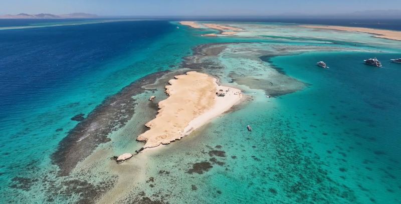
On a Red Sea kite safari most of this is handled by the crew: the boat moves to an island each day based on the forecast and conditions.
Questions
How do you read a Windguru forecast?
Columns correspond to the local times in the header; read the spacing there, as it is not always hourly. Rows show weather variables, especially wind speed, gusts and direction: the arrow points downwind, while hovering shows where the wind comes from, for example NW (320°). The WG table is a weighted model mix, with individual models below it.
What is the difference between Windguru and Windy?
Windguru shows a spot forecast as a colour-coded table for each model, plus a blend of them at the top. Windy is mainly an animated map that shows where the wind is coming from and where a front is moving, and it can compare models side by side for your chosen location.
How far ahead can you trust a wind forecast?
According to Windguru, forecasts up to 3 days are generally reliable, 5 to 7 days can still be of some value and beyond that they are largely speculative. Before travelling, check the latest model run and any current readings from a station that represents your spot in that wind direction; compare observations with the forecast for the same time.
How many km/h or m/s is 1 knot?
1 knot is 1 nautical mile per hour, which is 1.852 km/h or about 0.5 m/s. Most kiters and kite sizing charts work in knots, so it is worth switching your forecast app to knots.
Sources
- Windguru model list: GFS 13 km, ICON 13 km, IFS-HRES 9 km, ICON 7 km (Europe), WRF 3 km (CZ), ALADIN 2.3 km (Central Europe+), ALADIN 1 km (CZ), UKV 2 km (UK), HRRR 3 km (US); regional models rely on boundary conditions from global models and can capture local phenomena including sea breezes www.windguru.cz (checked 17 October 2026)
- Windguru shows a separate table per model for each spot; the number after the model name is its resolution in km; init time is in UTC, forecast times are local; the first table, marked WG, is a blend of all available models www.windguru.cz (checked 17 October 2026)
- The WG model mix is a weighted average of all models, weighted by model resolution, data freshness and individual model preference www.windguru.cz (checked 17 October 2026)
- Windguru wind speed is wind at 10 metres above the ground; the Windguru rating is a somewhat historic quick guide to windsurfing conditions, based primarily on wind speed www.windguru.cz (checked 17 October 2026)
- Forecasts up to 3 days are generally reliable, 5-7 days can still be of some value, long-term forecasts up to 16 days (GFS) are more for curiosity; forecast times are local, only init time is UTC www.windguru.cz (checked 17 October 2026)
- Windguru free gives full access to high-resolution models only at Windguru's own spots; PRO unlocks them for custom spots and any point on the map; price 25.90 EUR per year www.windguru.cz (checked 17 October 2026)
- Coarse resolution can cause a coastal forecast to underestimate wind on the water; CS+ takes wind from a point further offshore, is experimental and does not guarantee a more accurate forecast www.windguru.cz (checked 17 October 2026)
- Windguru forecast table (Nechranice spot): columns show times at varying intervals; rows show wind speed, gusts and wind direction (→); the arrow for a NW (320°) wind points south-east, i.e. downwind; ALADIN 1 is listed among models in the free version; wind speed units including knots can be set in the Options menu www.windguru.cz (checked 17 October 2026)
- Nautical mile = 1852 m; the knot is the unit of speed used in marine and aerial navigation (1 knot = 1 nautical mile per hour) www.bipm.org (checked 17 October 2026)
- Models on Windy: ECMWF about 9 km, GFS about 22 km, ICON global about 13 km, ICON-EU about 7 km for Europe only community.windy.com (checked 17 October 2026)
- Windy's Compare feature shows all available models side by side for a chosen location community.windy.com (checked 17 October 2026)
- Windy's Observation vs Forecast feature compares what a weather station observed with what the models predicted over the last few days community.windy.com (checked 17 October 2026)
- ALADIN, run by the Czech Hydrometeorological Institute, has a horizontal grid spacing of 2.325 km (about 2.3 km) and forecasts up to 3 days ahead www.chmi.cz (checked 17 October 2026)
- The official Počasí ČHMÚ app offers an ALADIN meteogram up to 72 hours ahead, including average wind and gusts www.chmi.cz (checked 17 October 2026)
- Kite Life video: cross-check forecasts against local wind meters; at 6:51-7:22 it explains how buildings and trees can make a station unrepresentative of the water in certain wind directions; arrows show where the wind travels www.youtube.com (checked 17 October 2026)
- Kitesurf College video (from 9:21): forecasts can miss sea breezes; gusts should be close to the base wind; at 14:24-14:28 and 17:03-17:16 it warns that gust fronts can arrive far ahead of cloud and rain and returning too late can make landing impossible www.youtube.com (checked 17 October 2026)
- Paradise kite safari: transfer to an island according to conditions, crew picks the best spots according to the wind, choice based on the best forecast paradisekitesurf.cz (checked 17 October 2026)
- Met Office distinguishes a diagnostic gust at a specific time from maxima over the previous 1 or 3 hours; a forecast gust is not a guaranteed maximum actual wind speed www.metoffice.gov.uk (checked 17 October 2026)
- UKV runs initialized at 03 and 15 UTC extend to 120 hours (5 days); forecast length varies by run www.metoffice.gov.uk (checked 17 October 2026)
- IKO Discovery includes assessment of the spot, environment and activity, wind and physical location, and securing a kite on land www.ikointl.com (checked 17 October 2026)
- Ozone safety instructions, pages 4-5: use a partner for launching and landing, stay within your ability and do not use a kite in thunderstorms or lightning ozonekites.com (checked 17 October 2026)
- Jája on Instagram, 30 June 2025: „Předpověď? Luxusní. A už valíme. 9 hodin na otočku? Nevadí.“ (trip to Rügen) www.instagram.com (checked 17 October 2026)